For years, supply chain conversations around last mile delivery have focused on routing optimization, carrier capacity, and delivery speed. These factors remain important, but as retailers and logistics providers continue compressing fulfillment windows, attention is increasingly shifting to a much smaller but operationally critical challenge: what happens after the delivery vehicle actually arrives.
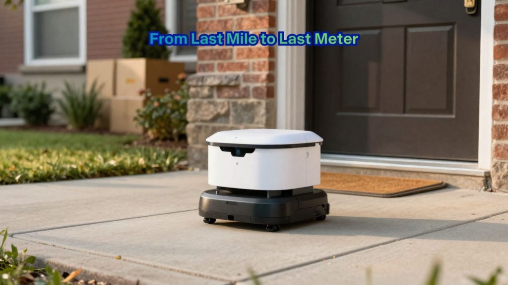
The concept of the “last meter” moves beyond simply getting a truck to the correct address. Instead, it focuses on helping drivers navigate the final steps of delivery more efficiently, whether that means identifying the best parking location, the fastest walking path to a building entrance, or the correct access point inside increasingly complex urban and commercial environments.
Delivery execution depends not only on route planning but also on the constant feedback loop between planning systems and real world driver behavior. The plan is not always realistic. There are things changing throughout the day that require a much more dynamic approach. Taking feedback from the driver into account in order to improve the plan is becoming essential for efficient operations.
As companies attempt to improve delivery density, reduce failed deliveries, and maximize driver productivity, resolving that operational disconnect between the planned route and actual execution is becoming more important than ever. This is where the last meter comes into focus as a distinct area of innovation.

Traditional navigation systems have historically focused on directing drivers to a geographic destination, often a street address. But that level of precision is increasingly insufficient in dense urban areas, apartment complexes, campuses, hospitals, and commercial environments where the final delivery handoff can consume significant time and create costly delays.
New AI powered last meter guidance solutions are designed to provide more granular delivery direction after a driver exits the vehicle. These systems use sensor and positioning data collected from handheld devices and driver navigation systems to better understand how deliveries are actually completed in the field, rather than how they were planned on a map.

The system works by deploying a client side component on the driver’s device that automatically collects movement traces in the background. It attempts to differentiate between traffic stops, parking locations, walking paths, and building entrances. Over time, repeated delivery patterns allow the platform to identify commonly used parking areas and preferred delivery approaches for each location.
The more deliveries that are executed, the more it improves the directions for the next one. Importantly, the benefits are shared across the broader delivery community, not just the individual driver. The goal is not to rigidly dictate driver behavior but to create operational recommendations that improve delivery consistency and reduce wasted motion at every stop.
While saving a few seconds on a single stop may appear insignificant, those efficiencies compound rapidly across large delivery networks. If a solution saves 30 seconds of delivery time per stop, that might not sound like much in isolation. But at the end of the day, the driver may have saved half an hour and can now make another five deliveries. Across a fleet of hundreds of vehicles, the impact becomes substantial.
As labor costs rise and delivery expectations tighten, logistics organizations are increasingly searching for operational gains in smaller increments rather than relying solely on large scale network redesigns. Every second shaved from the final meter translates directly into improved productivity and lower costs.

Most large language models still struggle to understand geospatial reasoning. While generative AI tools have rapidly improved conversational capabilities and workflow automation, many models still produce unreliable results when dealing with complex routing, mapping, and logistics constraints. They simply do not understand geospatial relationships and can hallucinate in certain complex queries involving directions, restrictions, and sequencing.
To address that issue, some companies are introducing what is called location reasoning, a geospatial grounding layer designed to provide AI systems with contextual location intelligence. This technology helps AI agents and logistics systems better interpret routing constraints, location data, and real world operational conditions before generating decisions or recommendations.
For much of the past two years, the industry’s AI focus centered heavily on generative AI. In 2026, however, more conversations are shifting toward what some are calling physical AI: the use of AI systems inside real world operational environments involving robotics, autonomous systems, and dynamic execution workflows.
AI’s role in logistics is rapidly evolving beyond simple automation or predictive analytics. Increasingly, the next phase appears focused on helping AI systems better understand and operate inside physical environments where precision, location awareness, and real time adaptability matter just as much as raw computational power. The last meter of delivery, it turns out, may be where the next great supply chain battle is won.